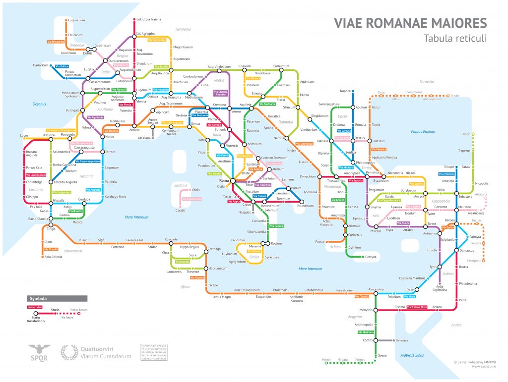
This is a subway-style map of Roman Roads c. 125 CE created by Sasha Trubetskoy. Trubetskoy has created additional maps focusing on specific parts of the Roman empire such as Gaul and Britain as well.
Just another nerd.
This is a subway-style map of Roman Roads c. 125 CE created by Sasha Trubetskoy. Trubetskoy has created additional maps focusing on specific parts of the Roman empire such as Gaul and Britain as well.
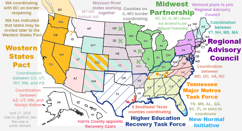
Over on Twitter, Alfred Twu has been creating and updating a map of the United States, showing how the formation of various state-level COVID-19 pacts given the lack of federal leadership.
This looks like the sort of map you’d find next to an audio log in a post-apocalyptic video game.
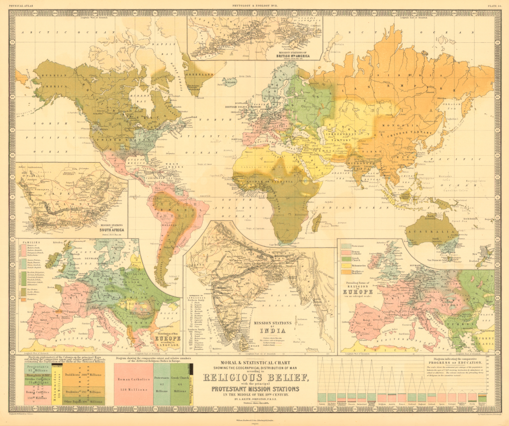
Alexander Johnston created this map showing distributions of religions around the world that was published by Willi Blackwood & Sons in May 1854. (Via Princeton University Library).
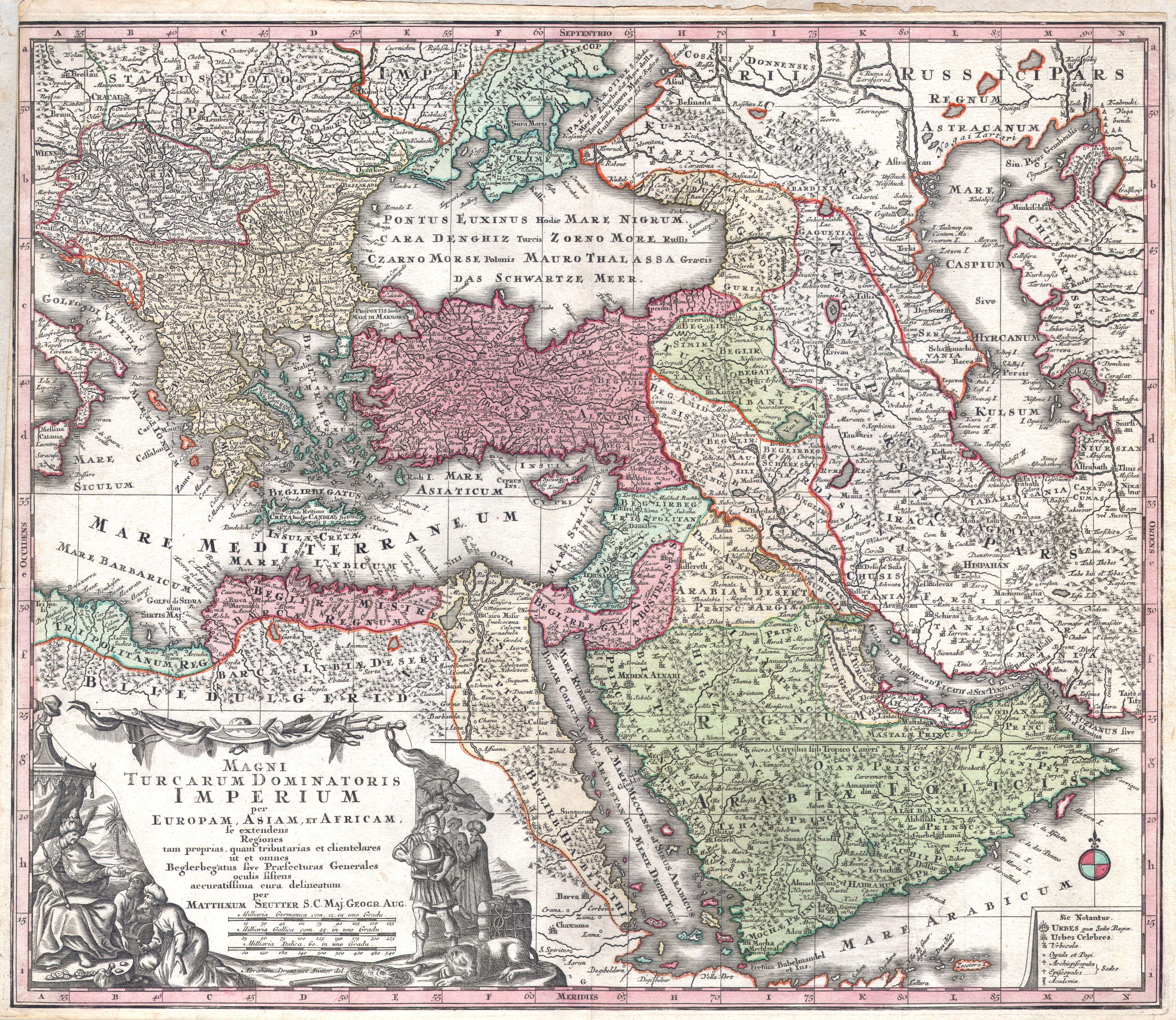
Detailed map of the Ottomon Empire published in 1730 by German map publisher, Matthäus Seutter.
Bernard Sleigh created this detailed An Ancient Mappe of Fairyland, Newly Discovered and Set Forth in 1920. The map depicts locations of various fantasy worlds from literature of the 19th and early-20th centuries.

I created a high-resolution JPG version of the map here (60mb) based on the Library of Congress’ 280mb TIF version.
Now this is my idea of a replica. Based on the map and markers Robb Stark uses to plot army movements in the HBO adaptation of Game of Thrones, the map of Westeros itself is 50″ x 35″ and made of cloth with a paper backing. The map markers are 4.5″ to 6″ tall. The entire set comes with a hinged-lid storage box to hold the set. All for the low, low price of $200, and available in April 2014.
